Muro – Caseta Paiano (PR-CV 227) – Alt Montagut – El Teix – Cava de l’ Habitació – Cava Gran o Cava Arquejada – Shelter Montcabrer del CE d’Alcoi – (PR-CV 27) Santuari de la Mare de Déu del Castell de Agres.
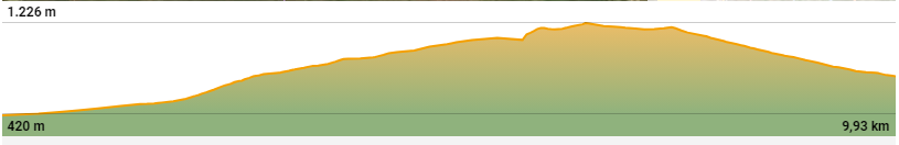
| Distance: 9,93 km |
| Difficulty: Moderate |
| Time on the go: 2 h 53 min. |
| Average speed:: 3,4 km/h |
| Type of route: linear, one-way way |
| Maximum altitude: 1263 m |
| Minium altitude:: 420 m |
| Positive slope: 979 m |
| Negative Slope: 632 m |
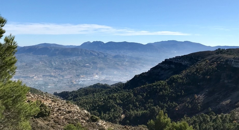
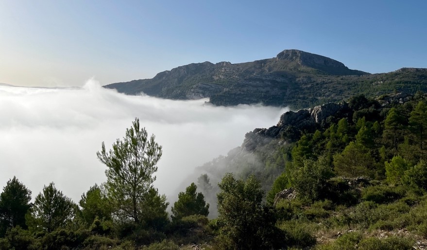
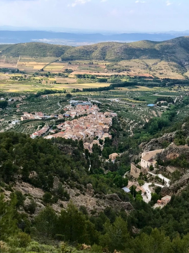
DESCRIPTION OF THE ROUTE: Agres is a municipality with step slopes in the Valencian Country locates to the north of the Comarca del Comtat de Cocentaina and has 564 habitants. It is part of the Serra Mariola mountain range, which is a mountain range of great botanical interest for its aromatic and medicinal plants, as well as for the production of spirits such as “Herbero”. On the other hand, there is a growing interest on the part of hikers who want to enjoy nature do routes through this mountain, we will talk about this in detail later. The town of Agres is full of fountains and its old town is well preserved. The Agres cellars stored the snow is guaranteed almost every winter.
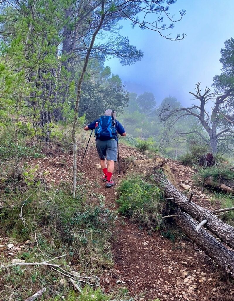
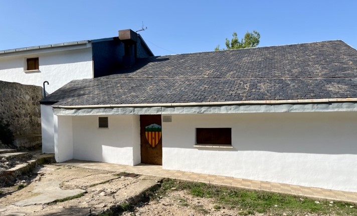
Departure: Parking of the Hermitage of Sant Antoni.
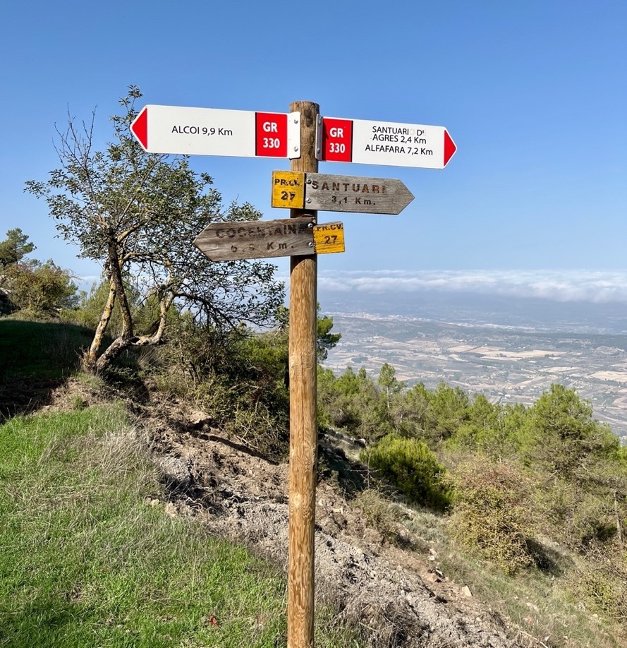
The first meters run along a steep path surrounded by a villa on the right and left, at the junction with the path of the old Alcoy-Villena train track we will follow the PR-V 277 path towards Alt de la Penya Frare.
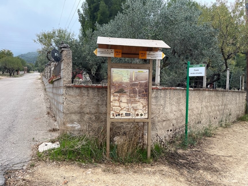
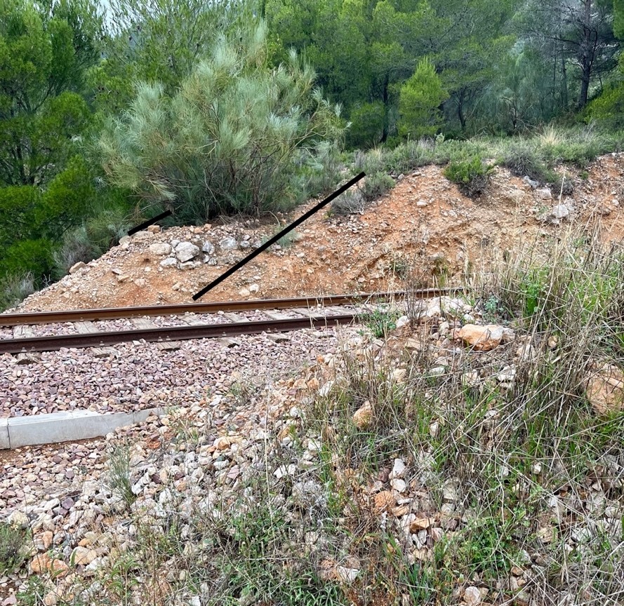
At the end of the road cross the Alcoy – Xàtiva train track along the path that is in front of the link, a meter further on, again in the PR-V 227 (Alt de la Penya Frare).
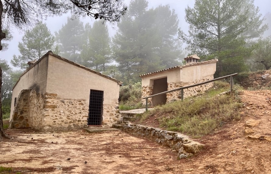
The path ascends the slope of the mountain range, at an altitude of 787 m. pass next to a small shelter (La caseta Paiano), and leave it on the left.
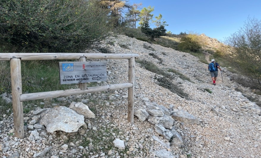
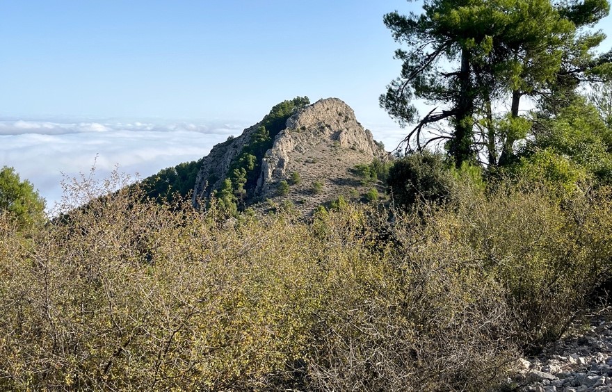
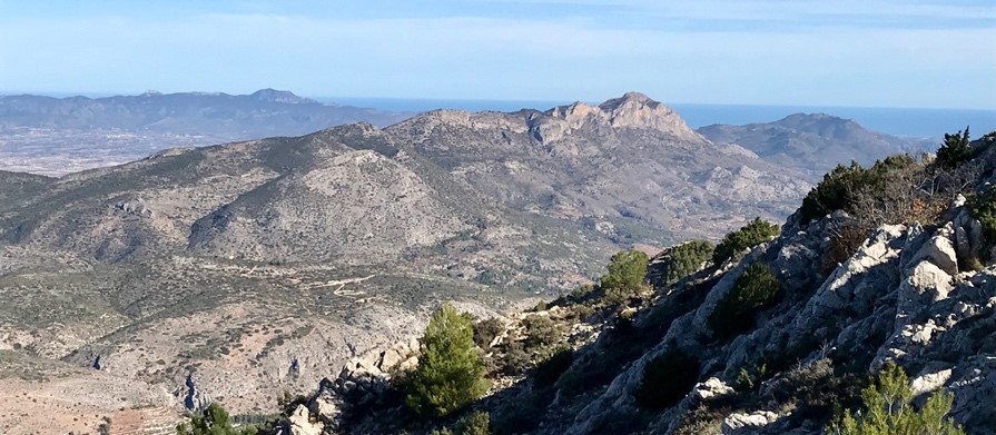
Walk along the track attentive to see two landmarks on the left. Leave PR-V 277 at this point, following a path on the left that goes up to Alt de Montagut (1222 mets.), to Molló del Teix (1263 m.) passing under the Peña Els Peons (1114 mets.), first through sounds weird, and then through the sound weird mountain range.
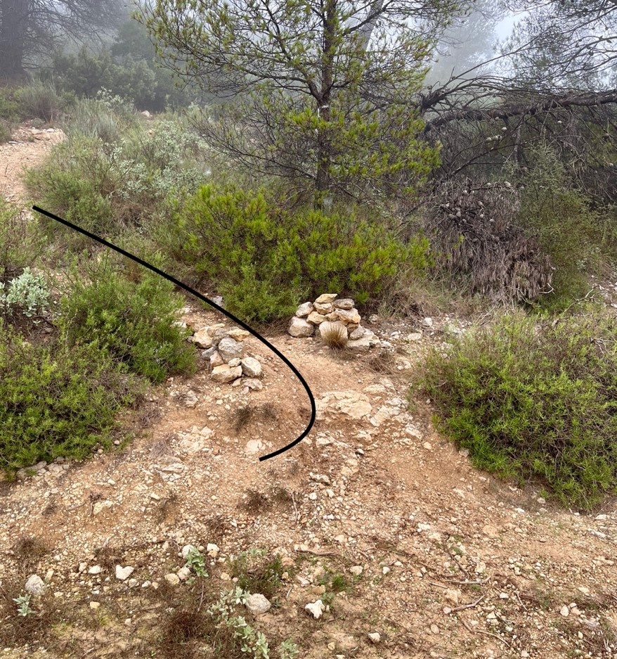
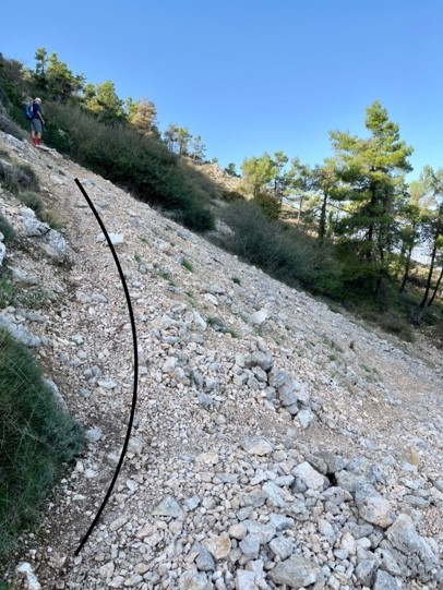
A little before reaching Alto de Montagut in a rubble, you will see a botanical trail sign. At this point the path is divided into two. Continue on the left, in a steep climb, passing through the upper part of the micro-reserve of flora of the Runar dels Teixos, and through the Collada de l’Alt de Montagut.
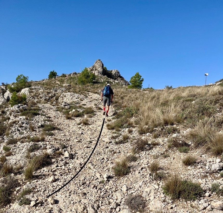
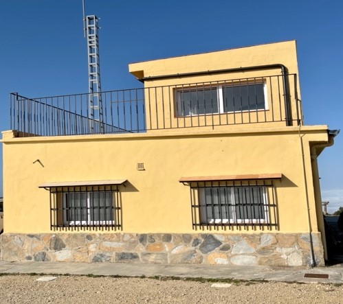
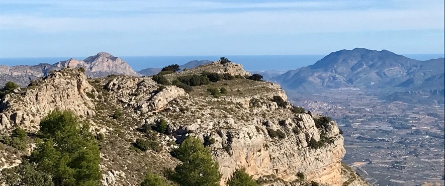
It is necessary to follow the most marked path until you reach the Molló del Teix, with its observation house.
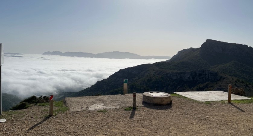
After the visit to the Cava Gran, we will return to the Montcabrer Refuge (Refugi el C.E. Alcoi) and begin the descent towards the town of Agres through the PR-CV 27 that coincides with GR 330, until you reach the recreational area of the Sanctuary of Agres.
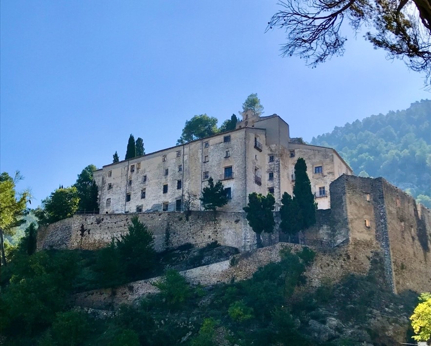
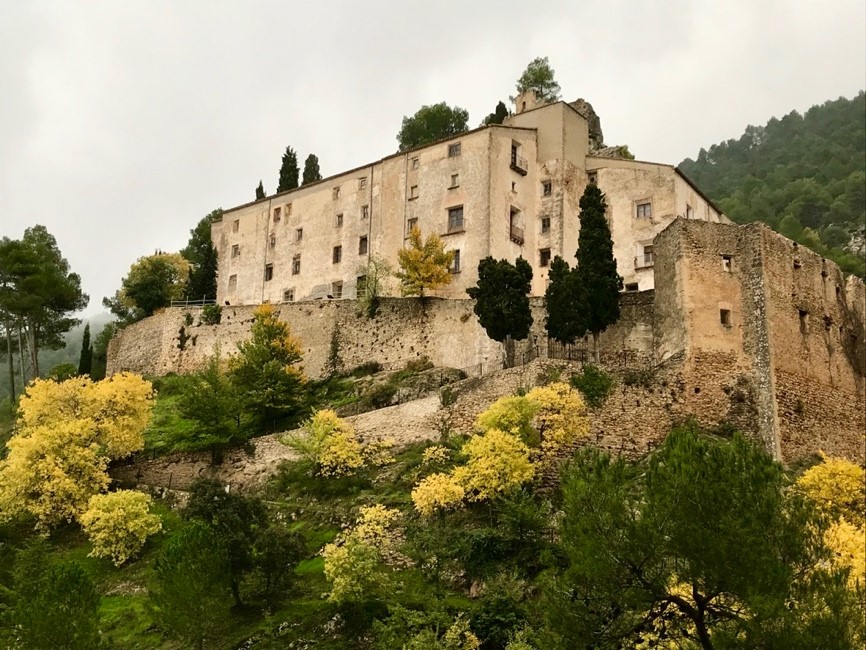
Final del 1r. Tram: Sanctuary of the Mare de Déu del Castell.
MORE DETAILS OF THE STAGE
The descent from the Sanctuary to Agres, will allow you to walk through the town of Agres and discover some of the most beautiful corners of this municipality.
The small town is a gem for tourists. The peculiarity of its urban center with its steep streets and the opportunities it offers hiking lovers, make it an obligatory stop on the routes through the municipalities of the Sierra Mariola.
The descent from the Sanctuary to Agres Will allow us to stroll through the town of Agres and discover some of the most beautiful corners of this municipality.
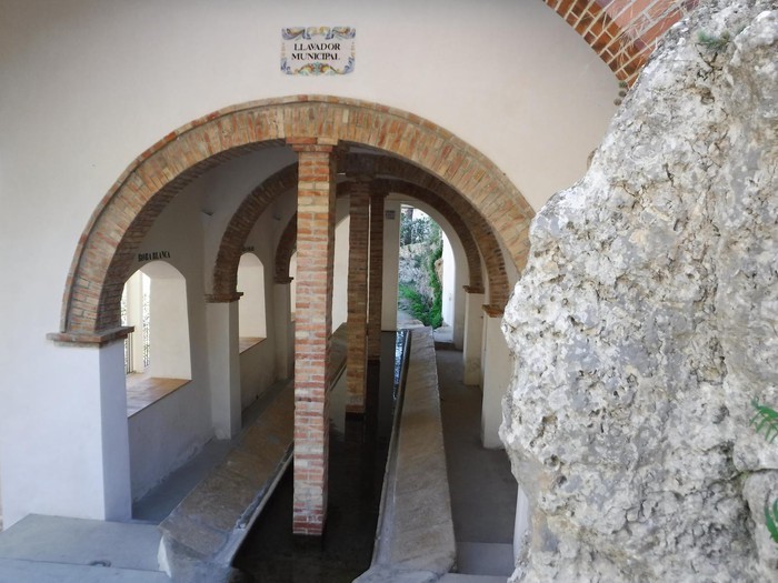
It has a wide variety of historical heritage worth visiting. Without going too far, we can approach the safareig municipal from the nineteenth century, and one of the largest preserved in the province of Alicante. A corner prepared for the visitor to make a stop letting you relax by the noise of the water. The Sanctuary of the Virgin of the Castle, the Talaia Tower, and the cellars, which we have known during the route.
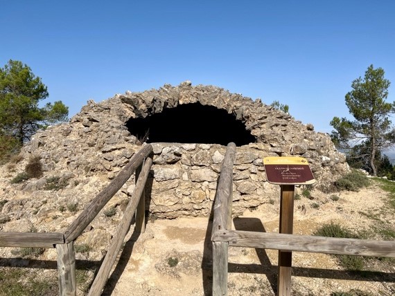
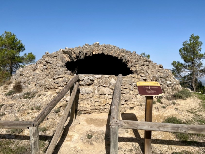
Les Caves o pous de Neu
These cellars or snow wells, – as Artur Masriera says “, figured a true round about of twenty meters of crushed stone foundation that can contain a cylinder of snow of that height and of ten or twelve in diameter, and all this sunk in the ground…” -, they were used to store snow in the form of ice and sell it after winter to preserve food, drinks, make ice cream. This was made from the snow that fell during the winter, which was pressed inside the cellars, in successive layers of snow and straw. In this way, it was possible to have ice even in summer. It was transported to the neighboring villages Alcoy, Villena, Almansa, Alicante, Muro and Cocentaina and even to the coast, especially during the night, using machetes and carts pulled by cargo animals. Snowmen were the people who were responsible for accumulating snow in the cellars or snow wells. As Paco Esteve i Beneito says in the book SI HA NEVAT, “The inhabitants of Agres climbed the mountain range every time a snowfall fell in order to fill this well, the mountain range was full of people harvesting snow.
From all directions came the songs of the snowmen who, loaded with a hut and a wooden shovel, kept making trips to the well to pour it out and make sure that the foreman correctly pointed the load at them in order to charge it afterwards.” This system was in use until the early twentieth century.
Cava de l’Habitació, is located on the upper edge of a hillside. The circular well with a depth of 10 meters is preserved. It has three windows or upper openings and its inner diameter is 7 meters. It maintains, in part, the 30 cm thick semi-spherical dome, which, like the rest of the construction, is made of masonry. The entrance to the mouth is located in the NE of the cava on a lower level. The date of construction would correspond to the seventeenth century.
Cava de l’Habitació,
Is located on the upper edge of a slope. The circular well with a depth of a 10 meters is preserved. It has three windows or upper openings and its internal diameter is 7 meters. It retains, in part, the 30 cm thick hemispherical dome which, like the rest of the construction, is made of mansory. The access to the mouth is located to the NE of the cava at a lower level. The date of the construction corresponds to the XVII century.
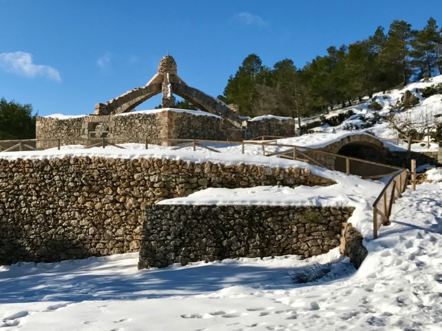
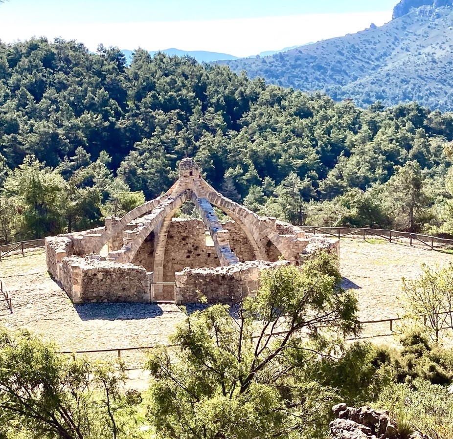
La Cava Gran (also called Arquejada),
An unmistakable symbol of this mountain range. Built between the seventeenth and eighteenth centuries, it was in use until the early twentieth century, although it was used again occasionally during the Civil War. It has 11 meters of interior diameter, with six Gothic-style arches pointed at the ends of the outer hexagon and attached to the center; This structure supported the beam and reed dome, topped with moruna tile.
Inside we can see a yew tree. At the entrance to the interior there is a fountain with a thread of water all year round.